segunda-feira, 20 de agosto de 2018

014 - Anta da Cavada


Also known as Dolmen dos Fiais da Beira.

Chronology: Neolithic.
Located in Fiais da Beira village, municipality of Oliveira do Hospital, district of Coimbra.
Access: inside the village of Fiais, while heading East, take a left road indicated by a plaque.  Follow the track for about 500m The monument will be at your left.  Accessible to normal cars with some difficulties. Part of the track is better done by foot if you do not have a jeep type of car. There are plaques indicating the way, but just at the beginning of the track.
Coordinates: 40.245867º / 7.551450º

VER NO GOOGLE MAPS

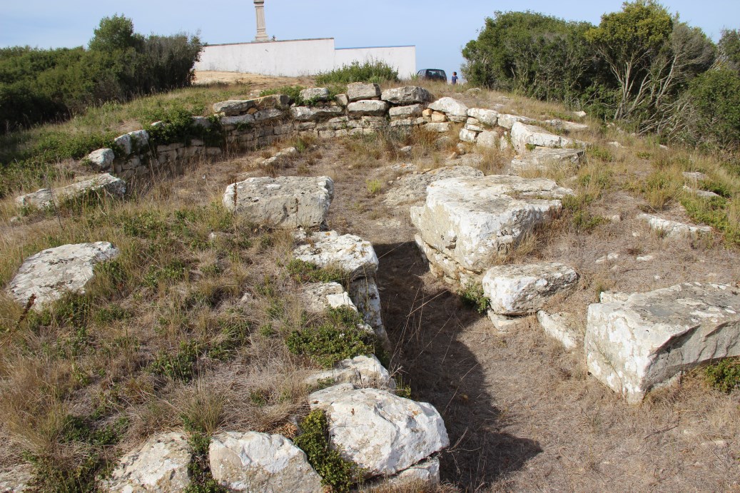
Bibliography:


013 - Hypogea of Sobreira de Cima


Chronology: late Middle Neolithic, Late Neolithic (Early Chalcolithic ?).

Located near Marmelar village, municipality of Vidigueira, district of Beja.
Access: Not accessible to general public. Partially destroyed by the construction of a power station. The preserved part is inside the limits of the station, close to Alqueva dam.
Coordinates: 38.111108º / 7.294819º

VER NO GOOGLE MAPS

It is a necropolis of at least 5 hypogea, excavated in a context of emergency. An excavation and study that I have coordinated and was supervised in the field by Manuela Coelho. (Project by Era Arqueologia S.A.).

Bibliography:
Valera, A.C. (2013) - Sobreira de Cima. Necrópole de hipogeus do Neolítico (Vidigueira, Beja), Era Monográfica, 1, Lisboa, Nia-Era.


Closing of Hypogeum 1.


Deposition of amphibolite ingots in the closing of Hypogeum 1.


Human depositions inside Hypogeum 1


Last human deposition and ossuary in Hypogeum 5.

012 - Dolmen de Cortiçô


Chronology: Neolithic, Chalcolithic.

Located in Cortiçô village, municipality of Fornos de Algodres, district of Guarda.
Access: In the municipal road from Infias to Cortiçô, pass the cross to Cortiçô and continue in the same road for 1800m. Then take the track at left and course it for about 680m. Accessible to normal cars. There are signing  plaques. It is integrated in an archaeological tour (with Dolmen da Mantaça and the walled enclosures of Fraga da Pena and Castro de Santiago).
Coordinates: 40.401473º / 7.301923º

VER NO GOOGLE MAPS

Bibliography:
Cruz, D. (1993) - Monumentos Megalíticos do Concelho de Fornos de Algodres, Estudos Pré-Históricos, 1. p. 11-112.
Valera, A.C. (2007) - Dinâmicas locais de Identidade: estruturação de um espaço de tradição no 3º milénio AC (Fornos de Algodres), CMFA.


011 - Dolmen de Rio Torto


Chronology: Neolithic.

Located in Rio Torto village, municipality of Gouveia, district of Guarda.
Access: From the cross to Rio Torto village in the N-17 course 650m to SW. Then take a track at right for 120m. Accessible to normal cars. There are signing  plaques at N-17. The monument can be seen from the road N-17.
Coordinates: 39.180354º / 7.423943º

VER NO GOOGLE MAPS

Bibliography: Senna-Martinez, J.C. (1989) - Pré-História Recente da bacia do médio e alto Mondego. Algumas contribuições para um modelo sociocultural. Dissertção de doutoramento, FLUL, Lisboa.


010 - Anta Grande do Tapadão


Chronology: Neolithic.

Located in Aldeia da Mata, municipality of Crato, district of Portalegre.
Access: From the cross to Aldeia da Mata, take the road N-363 to East. Course 770m and take a track at left. Course the track to East for about 720m. Accessible to normal cars in summer. May present problems in winter.
Coordinates: 39.180354º / 7.423943º

VER NO GOOGLE MAPS

Bibliography:


009 - Dolmen de Madorras 1


Chronology: Neolithic. (Second half of the 4th, beginning of the 3rd millennium BC).

Located in S. Lourenço de Ribapinhão, municipality of Sabrosa, district of Vila Real.
Access: From the roundabout outside the village of Arcã in direction to the village of Vilar de Celas, course 450m. Then take the track at left (East) for 40m. Accessible to normal cars.
Coordinates: 41.175491º / 7.363562º

VER NO GOOGLE MAPS

Bibliography: Cruz, D.; Gonçalves, A.A.H.B. (1995) - Mamoa 1 de Madorras (Sabrosa, Vila Real). Datações radiocarbónicas. Estudos Pré-Históricos, 3, p.151-159.


domingo, 19 de agosto de 2018

008 - Tholos do Barro


Chronology: Chalcolithic.

Located in Barro village, municipality of Torres Vedras, district of Lisbon.
Access: Track leading to a hill where a saint statue is, between the villages of Barro and Serra da Vila, south of Torres Vedras. Accessible to normal cars.
Coordinates: 39.040279º / 9.154551º

VER NO GOOGLE MAPS

Bibliography:


007 - Anta Capela da Sra. do Livramento


Christianized megalithic monument (chapel built over a megalithic monument), also known as Anta Capela de S. Brissos.

Chronology: Neolithic

Located in Santiago do Escoural village, municipality of Évora, district of Évora.
Access: just next to the road CM-1079. In the south of Escoural village take the right to the M-370. Then take the right to the CM-1079. Course for 3km and get to a track at right. The monument is at 80m.
Coordinates: 38.312859º / 8.074609º

VER NO GOOGLE MAPS

Classified as National Monument in 1910.

Bibliography:


006 - Dolmen dos Fiais da Telha


Chronology: Neolithic, Chalcolithic. A nice exemplar of a classic megalithic monument from the prime times of megalithic architectures in Portugal.

Located in Fiais da Telha village, municipality of Carregal do Sal, district of Viseu.
Access: track from the football field. Course the track from the football field about 1500m. Take the SO direction track and at 1km take the left and at the next cross again left.. Accessible to normal cars, but a bit hard. There are no plaques indicating the way in the tracks. Using the coordinates is useful.
Coordinates: 40.263783º / 7.561740º

VER NO GOOGLE MAPS

Bibliography: Senna-Martinez, J.C. (1989) - Pré-História Recente da bacia do médio e alto Mondego. Algumas contribuições para um modelo sociocultural. Dissertção de doutoramento, FLUL, Lisboa.


005 - Dolmen do Seixo da Beira


Chronology: Neolithic, Chalcolithic. With Bell Beakers.

Located in Seixo da Beira village, municipality of Oliveira do Hospital, district of Coimbra.
Access: track coming out of M-507. Course the track for about 650m. Accessible to normal cars. There are plaques indicating the way.
Coordinates: 40.264281º / 7.503985º

VER NO GOOGLE MAPS

Bibliography: Senna-Martinez, J.C. (1982) - Materiais campaniformes do concelho de Oliveira do Hospital (Distrito de Coimbra), Clio, IV, p.19-34.


004 - Dolmen da Bobadela


Also known as Anta do Pinheiro dos Abraços.

Chronology: Neolithic, Chalcolithic. With Bell Beakers.

Located in Bobadela village, municipality of Oliveira do Hospital, district of Coimbra.
Access: just next to the road N-230, 100m from the roundabout with the access to Bobadela. Accessible to normal cars. There are plaques indicating the way.
Coordinates: 40.220139º / 7.5246455º

VER NO GOOGLE MAPS

Bibliography: Senna-Martinez, J.C. (1982) - Materiais campaniformes do concelho de Oliveira do Hospital (Distrito de Coimbra), Clio, IV, p.19-34.


003 - Pala da Moura


Chronology: Neolithic.

Located in Vilarinho da Castanheira village, municipality of Carrazeda de Ansiães, district of Bragança.
Access: track at right of the roadN-324, about 2300 from the cross at the entrance of the village. Course the track for about 1300m. Accessible to normal cars. There are plaques indicating the way.
Coordinates: 41.115373º / 7.112255º

VER NO GOOGLE MAPS

Bibliography:


With paintings inside.

002 - Anta de Zedes


Chronology: Neolithic.

Located in Zedes village, municipality of Carrazeda de Ansiães, district of Bragança.
Access: track at left (coming from south) of the road M-628, about 350m of Zedes village. Course the track for about 250m. Accessible to normal cars. There are plaques indicating the way.
Coordinates: 41.163282º / 7.173676º

VER NO GOOGLE MAPS

Bibliography:


With paintings inside.

001 - Anta da Matança


Also known as Casa da Orca de Corgas de Matança.

Chronology: Neolithic, Chalcolithic.

Located in Matança village, municipality of Fornos de Algodres, district of Guarda.
Access: track at left (coming from south) of the road M-587, about 150m of Mantança village. Course the track for about 350m. Accessible to normal cars. There are plaques indicating the way. It is integrated in an archaeological tour (with Dolmen da Mantaça and the walled enclosures of Fraga da Pena and Castro de Santiago).
Coordinates: 40.400838º / 7.315747º

VER NO GOOGLE MAPS

Bibliography:
Cruz, D.; Cunha, A.; Gomes, L.F. (1988-89) - A Casa da Orca de Corgas de Matança, Portugália, Vol. IX-X, p.31-47.
Valera, A.C. (2007) - Dinâmicas locais de Identidade: estruturação de um espaço de tradição no 3º milénio AC (Fornos de Algodres), CMFA.